Scenic Trails
Honan Ave Community Hiking and Biking Trail
Eagle Trail
Joseph P Whipey Trail
Cambria County Veterans
Memorial Greenway Loop Trail
Family Fun easy to walk
Open Year Round

Johnstown Greenway, Honan Avenue, and Staplebend Tunnel Loop Trail

A biking trial providing family members with an enjoyable view, many rest stops, overlooks, Historical Landmarks, picnic pavilion, wildfire and a huge waterfall. The Honan Ave Hiking and Biking Trail Starts where the River Walk Trails ends on Iron Street, Picking up Honan Ave. (Please park in the lot on Iron and Honan Ave. You will be walking a few blocks on Honan when you enter the entrance. The 1st overlook is about ½ mile up Trail, where you can view the remains of Rosedale Coke Plant. One mile from entrance is a large active Beaver dam. At the 3.5mile mark is the huge water fall, a great place to rest and cool off. Do not go into creek / falls no entry allowed. The Trail continues just a short jog to the breast of Hinckston Dam, here you can rest and view the Cambria County Veterans Memorial.
You then cross the bridge and make a left turn on the Hinckston Run Road. While in this area you can explore other trails well mark. Joseph P. Whipey Trail, Eagle Trail and LHHV’s newest trail Alan Partsch Memorial Trail, you travel 1 mile to the end of dam where there is a Pavilion. Here you can rest and have lunch or a just a quick rest stop.
The trail will then continue on reaching route 271. Be careful as you cross route 271, onto Chapel Lane, (2 blocks) then it runs into Mineral Point Road. You follow Mineral Point Road down hill till you get to Mineral Point, (follow signs) you then cross the bridge, go thru tunnel, onto park lot on right side. Here you pick up the Staple bend Tunnel Trail, which connects with the River Walk Trail. The loop trail is 15 miles long.
For more information call LHHV 814-241-6123

Highlights Along the Trail Part 1
Rosedale Overlook ½ Mile from Entrance (Rosedale History)
The most infamous event in the history of Johnstown race relations occurred just two years after the Tulsa Race Massacre. On August 30, 1923, a shootout in the Rosedale neighborhood resulted in the death of Robert Young, a Black man, who, by accounts from the time, was drunk, as well as police officers Otto Nukem, Otto Fink, Joseph Louis Abrahams and John James.
In response, Johnstown Mayor Joseph Cauffiel issued an edict: “I want every Negro who has lived here less than seven years to pack up his belongings and get out.” He also called for banning any Black or Mexican laborers from coming to the city and prohibiting gatherings of Black citizens for any reason except church services. Ku Klux Klansmen burned crosses around the city.
Pennsylvania Gov. Gifford Pinchot admonished Caulfield, whose proposal never took legal effect. But an estimated 500 Black citizens nevertheless left the city within weeks after the edict.
In true Rustbelt fashion, remnants of coal and steel mill operations that existed within the Hinckston Run stream valley are all around (and below you) while you enjoy this Hiking Trail. First, along the entire trail to the dam, the Bethlehem Mines Corporation Mine No. 72 deep mine was and still is below your feet. As you first get on the trail and make the first sweeping right turn at the base of the hill, to the right (south) is a large flat previously disturbed site which was the former location of the Bethlehem Steel, Johnstown Plant, Rosedale Coke Plant. Although this plant was demolished and the soils remediated several decades ago, it operated for much of the 20th century and was a critical component to the entire Bethlehem Steel, Johnstown Plant steel mill operation. It used the coal from the mines in the Hinckston Run stream valley and other nearby locations to make steel. The coal was ignited in coke ovens and heated to very high temperatures. The solid carbon remaining in the oven was the coke. The coke was then transported by the hopper rail cars to an adjacent processing plant where it was further crushed, screened, and sized. It was then ready for use to make iron or steel in a blast furnace. As you walk up the trail (north) toward the falls and the Hinckston Run Dam, to the right (east) you will see remnants of huge refuge coal and slag piles. This area is/was known as the Rosedale or Riders Disposal Area. Coal and coke plant operational wastes were trucked up the Hinckston Run stream valley and dumped at this site for much of the 20th century. Many of the locals vividly remember the “orange glow” of the sky in the evenings as hot molten waste was dumped onto the land surface at this location. Although this area too has been identified as a hazardous waste disposal site, has undergone some reclamation, and is currently under strict supervision of federal and state environmental regulatory agencies, it is highly visible along the Trail and along the Hinckston Run stream corridor.

Beaver Dam - Part 2
At the 1 mile mark on your left hand side you will see a body of water. This area used to be a rifle range. Today it is home to a family of Beavers. On your right is the Hinckston Creek, here you can also view numerous beaver dams.

Waterfalls Part 3
At the 3.5 mile marker is the local famous Hinckston waterfall. There is a bench there for resting, and also getting a cool refreshing mist from the falls.
Just a short ride up the hill you will see the Hinckston Reservoir, at the front of breast is the Cambria County Veterans Memorial. Here you can view some of the men and women who served in all wars and conflicts in American History.

Hinckston Reservoir Part 4
Hinckston Reservoir
According to maps from the 1700s, the dam site used to be in Quemahoning Township, Bedford County, before that region was divided into smaller counties. When the dam was built in 1904, hundreds of horses and mules were used to haul slag, clay and stone.
At one time, Hinckston Run supported seven grist mills and three sawmills. The water power attracted settlers, to the area.
Cambria Iron Co. took property by force through eminent domain and seizure. The one main road was covered by the dam, and now there are two roads on each side.”
The lake formed by the dam is a mile long, 90 feet deep and contains 1 billion gallons of water.
Recreational opportunities include fishing, boating including kayaking, hiking trails, and picnicking.
LHHV Hiking Trails Around Hinckston Reservoir Part 5


The LHHV Forest
The LHHV Forest, located 3.5 miles north of Johnstown, in East Taylor & Middle Taylor townships, offers quiet refuge to all who seek the natural enchantment of a forest experience. Tucked away in the heart of the Hinckston Run Reservoir, the Forest is bordered on its Western ridge boundaries by the Hinckston Reservoir and the Hinckston Reservoir Wildlife Management Area. The LHHV Forest Is located on property that surrounds Hinckston Reservoir. Also, on site the Laurel highlands Veterans Memorial and reflection park. We have the Joseph P Whipey Trail, which is 1.5 miles long and runs parallel to Hinckston dam on eastern side. Behind the dam is the Eagle trail which connects you to the opposite side of dam (Waterfall Road).
Brand new this year is the…..
Merlo Laurel Highlands Veterans Memorial Bird Sanctuary, a unique wildlife center located at Hinckston Run Reservoir, at the end of the Honan Ave Hiking and Biking Trail, offering conservation-focused public programs, interpretive tours, and accessible trails that allow close views of captive and wild birds. The sanctuary is the newest addition to the Honan Ave Hiking Trail Complex, which incorporates the Hinckston Run Reservoir Natural Areas.
Today, the Sanctuary serves an important role as a primary visitation site not only for the general public but our veterans suffering from PTSD. Our grounds are open to visitors in every season, 365 days a year. Keep in mind stay away from areas newly planted with flowers and grasses.
Sanctuary Highlights
- Journey a paved road to the waters of Hinckston Run Reservoir to see hundreds of waterfowl in their natural habitat, including Trumpeter Swans, Canada Geese, Eagles, Blue Heroin, and a variety of duck species
- Birds of Prey and common raptors, including Bald Eagles, Red-tailed Hawks, Eastern Screech Owls and others can be seen in and around the sanctuary.
- A Pollinator Garden that uses native plants to attract hummingbirds and butterflies, is being built.
- Visitors can hike The Sanctuary Trail Dedicated to Alan Partsh an LHHV Director who [passing was way to soon. which makes a loop, The trail is flat and level. Along the trail you can see nesting Woodcock, and other wild birds native to our region. Please do not disturb the nests if found.
- A large picnic area is available for group lunches, at the pavilion 1 mile up the Hinckston Run Road, after you cross the gated bridge make a left.

Mineral Point Part 6
Mineral Point was destroyed in the Great Flood of 1889 on May 31, 1889 when the South Fork Dam failed, located on the south fork of the Little Conemaugh River. Mineral Point, located about one mile (1.6 km) below the Conemaugh Viaduct, was the first populated place to be hit by the rapid waters from the former Lake Conemaugh. About 30 families lived within the village of Mineral Point. After the flood, there were no structures, no topsoil, no sub-soil – only the bedrock was left. Approximately 16 citizens of Mineral Point perished in the flood. Today many call Mineral Point home.


Staple Bend Tunnel Part 7

Staple Bend Tunnel
Since, 2001, the Staple Bend Tunnel has been open as a separate area of Allegheny Portage Railroad National Historic Site. It is in the town of Mineral Point, 5 miles from Johnstown. From the trail head, it is a two mile walk to the Staple Bend Tunnel. You are welcome to bring bicycles, but no motorized transport for the limestone dust surfaced trail.
Finished in June 1833, the Staple Bend tunnel was advertised as the first railroad tunnel in the United States. It was the third tunnel of any kind built in the US, the first tunnels were for other canals in Pennsylvania.
Work began on November 21, 1831 and often occurred during inclement conditions. The men were paid $13 per month plus room and board for 12 hour days 6 days per week. Workers chipped and blasted 901 feet of solid rock to make the tunnel.
Approximately 14,900 cubic yards of bedrock were removed using black powder blasting. This was done by drilling three feet long holes and packing them with powder. Drilling one typical hole took up to three hours of hard effort using a three man crew. Nine to ten holes, each one-inch in diameter and thirty-six inches in length, were made before blasting. One pound of explosive powder wrapped in paper was pushed into each hole, tamped down, punctured with a sharp needle, and a fuse added. Fuses were lit with explosions to occur at mealtime. Workers would eat while the dust settled then get to work cleaning (mucking) the tunnel. Of the 36-inch hole drilled only 18 inches, or half of the hole, was blasted.
The tunnel grew about 18 inches each day, with both sides moving toward the center. On December 21, 1832 the workmen broke through the final barrier and connected the two ends of the tunnel. The workers and foremen actually celebrated their Christmas 1832 there. There was much celebration with speeches and toasts. The full tunnel excavation was completed in April 1833.
The ends of the Staple Bend Tunnel were lined with cut stone for safety. Rock and dirt might fall due to rain or other weather, or from the effects of the portage railroad going through the tunnel. The fancy entranceways to the tunnel were to impress the travelers and the general public. The style was described as a “Roman Revival style with low relief lintel supported by Doric pilasters on each side.” Of the money spent (the total cost was $37,498.85) nearly half was to build the fancy entrance ways.
After the Portage Railroad
In 1907 Henry Storey wrote that the east entrance facade of the tunnel had been removed for building purposes. He gave no indication of a date or the building on which the stones were used. The west entrance facade remains and has been restored to its former grandeur.
After the demise of the old Portage Railroad the tunnel had other uses. Neither the “new Portage” nor the Pennsylvania Railroad used the tunnel. It was instead a popular carriage route until the Flood of 1889. Afterward, Flood damage and other concerns made the tunnel a less desirable driving spot although local residents continued to visit, and even go courting at the tunnel up until the 1940s.
In the 1940s a concrete liner was added to the east portal of the tunnel and large water lines as well as a water vault structure were built. The Manufacturer’s Water Company closed the tunnel to the public, the water lines were used by Bethlehem Steel. In 2001 the tunnel became part of Allegheny Portage Railroad National Historic Site. Rock bolts, shoring posts, and other reinforcements were added as well as a thin mortar between the historic blocks.

Path of the Flood Trail Part 8

The loop trail joins the Flood Trail below the Staple Bend Tunnel
This historical trail enables users to start 300 yards west of the breached South Fork Dam on an off-road section of trail and follow the same watercourse that floodwaters took in 1889, when they surged into Johnstown. The Path of the Flood Trail provides numerous trail-side markers that tell the story and enable users to visualize the scene within the Little Conemaugh River valley, which remains largely unchanged more than 130 years later. Additionally, this trail is naturally beautiful and challenging with some steeper grades and varying trail surfaces.
The Path of the Flood offers a 13.86-mile bicycle ride that’s both intellectually and physically satisfying. Beginning 300 yards from the breast of the dam, visitors will first encounter a more challenging section of trail as they travel through the recently reclaimed Stineman “bony” piles, then “share the road” for a short distance to the remaining off-road trail experience. A four-mile section from the trailhead in Ehrenfeld to Mineral Point offers scenic views, educational trail side markers and moderately challenging slopes when riding eastward. Below Mineral Point and the two-mile Staple Bend Tunnel Trail, which is managed by the National Park Service, bicyclists will be challenged with steep grades for one mile. Following another mile on more-level dedicated trail to a hillside park above Franklin, the rider will travel along public streets into East Conemaugh before enjoying another challenging short section of trail in Woodvale Heights, providing an extraordinary view of the city of Johnstown. Visitors will then finish the short remaining distance on public streets before reaching the Path’s terminus at the Johnstown Flood Museum.
While the Cambria County Veterans Memorial Loop Trail only contains portions of the Path of the Flood Trail from Mineral Point to Johnstown, you can plan your full visit of the entire trail by visiting www.cambriaconservationrecreation.com/path-of-the-flood-trail/.
Franklin Ball Field Part 9
Here the Gustkey family bought and built a small park for family gatherings and a Veterans Memorial, for all veterans. At the same location is the Franklin Ball Field. Below the ball field, now gone, stood the Wheel Plant Homes 42 famlies lived here.
Franklin Boro Part 10

Franklin is a borough in Cambria County, Pennsylvania, United States. It is part of the Johnstown, Pennsylvania Metropolitan Statistical Area. At the 2010 census the borough population was 323,[1] down from 442 at the 2000 census.
The borough’s namesake is Benjamin Franklin.
At one time Franklin Boro was the richest boro or town in the northest due to Bethlehem Steel.
Sgt. Michael Strank, a Rusyn American and one of the US Marines pictured in the photograph Raising the Flag on Iwo Jima, was raised in Franklin.
Franklin is located in southwestern Cambria County at 40°20′35″N 78°52′55″W (40.343073, -78.881873),[3] in the valley of the Little Conemaugh River. The river forms the northwest boundary of the borough, with East Conemaugh and a small portion of Johnstown on the opposite side.
At the 2000 census there were 442 people in 204 households, including 130 families, in the borough.
East Conemaugh Part 11

East Conemaugh is a borough in Cambria County, Pennsylvania, United States. It is part of the Johnstown, Pennsylvania Metropolitan Statistical Area. The population was 1,220 at the 2010 census
East Conemaugh is located in southwestern Cambria County at the valley of the Little Conemaugh River. It is bordered to the southeast, across the river, by the borough of Franklin. The center of Johnstown is 3 miles (5 km) to the southwest (downstream). Take a break in Conemaugh

Woodvale & Woodvale Heights Part 12

Woodvale is located at latitude 40.335 and longitude -78.904. The elevation of Woodvale is 1,211 feet above mean sea level. Woodvale below Woodvale Heights was hit hard from the all floods to hit Johnstown. A local church now closed… Gus Frank Laco feels a close bond to a beautiful old church in Woodvale, as he tells us this story.
His father – a Slovak immigrant to Johnstown – helped build it.
“I was baptized here, had my first Holy Communion here and everything else. There are a lot of good memories here,” Laco said.
Laco gathered with others Monday evening for the final Mass at what used to be Sts. Peter and Paul Church and more recently has been known as the chapel of St. Clare of Assisi parish.
Worshipers began gathering early at the 89-year-old church on Maple Avenue – parishioners, descendants of the immigrants who built the church and some who are both.
Many of them are elderly and wanted extra time inside the beautiful building with its arched ceiling.
They recounted ceremonies of the past – weddings and baptisms and funerals – and wondered what will become of the building now. Bishop Joseph Adamec of the Altoona-Johnstown Roman Catholic Diocese compared it to a funeral.
“It is more natural that this moment be a sad one. We recall our forebearers, and the people who were married here and celebrated here,” he said.
“Tonight reminds me of a funeral because we come to say farewell,” he told the congregation. “But we must also remember that the body was merely the house of the soul. So while we see a parting, it’s a life that continues as we celebrate our faith.”
“For your forebearers, it is about faith,” he said.
He, like the Rev. Leo Arnone, who is overseeing the closure, called for parishioners to focus on the future, rather than dwelling on the past.
Sts. Peter and Paul Church was founded in 1918, when immigrants were coming to Johnstown to work and wanted their own church and Masses.
It was restored after surviving the 1977 Johnstown Flood and celebrated its 75th anniversary in 1993.
But as Johnstown’s population decreased, so did attendance at churches, and in 2000, Saints Peter and Paul was merged with St. Anthony’s down the street. The new name became St. Clare of Assisi, and Sts. Peter and Paul’s new status was that of a chapel, not a church.
With Monday’s final Mass, all members of the parish will attend the former St. Anthony’s full-time.
Johnstown PA Her History Part 13
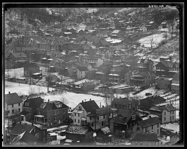
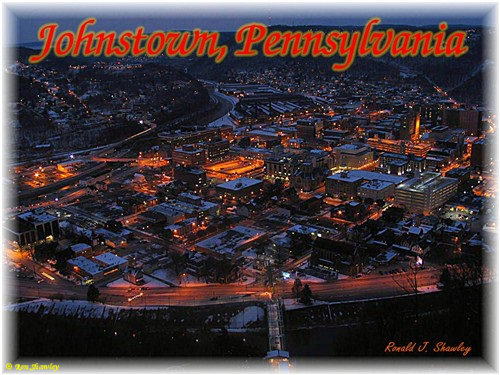
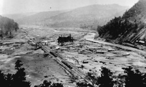
Johnstown, settled in 1770, has experienced three major floods in its history. The Johnstown Flood of May 31, 1889, occurred after the South Fork Dam collapsed 14.1 miles upstream from the city during heavy rains. At least 2,209 people died as a result of the flood and subsequent fire that raged through the debris. Another major flood occurred in 1936. Despite a pledge by President Franklin Delano Roosevelt to make the city flood free, and subsequent work to do so, another major flood occurred in 1977. The 1977 flood—in what was to have been a “flood-free” city—may have contributed to Johnstown’s subsequent population decline and inability to attract new residents and businesses.
Before becoming an independent town, Windber, Pennsylvania, was considered a part of the city.
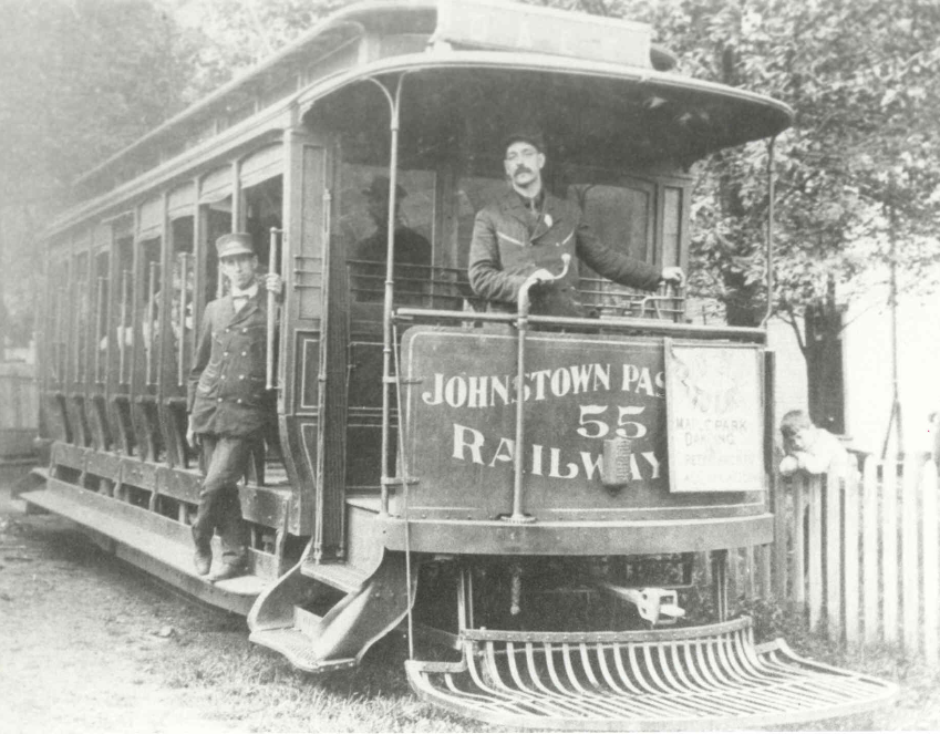
The city is home to five national historic districts: the Downtown Johnstown Historic District, Cambria City Historic District, Minersville Historic District, Moxham Historic District, and Old Conemaugh Borough Historic District. Individual listings on the National Register of Historic Places are the Grand Army of the Republic Hall, Cambria Iron Company, Cambria Public Library Building, Bridge in Johnstown City, Nathan’s Department Store, and Johnstown Inclined Railway.[10]
1790s
A settlement was established here in 1791 by Joseph Jahns, in whose honor it was named, and the place was soon laid out as a town.[11]
1800–1900
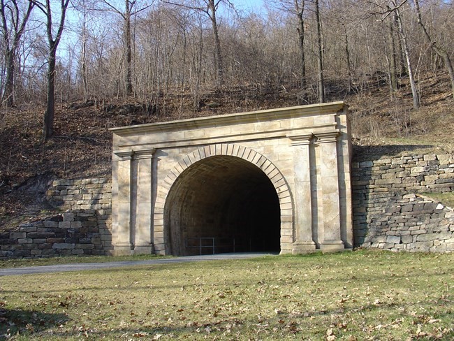
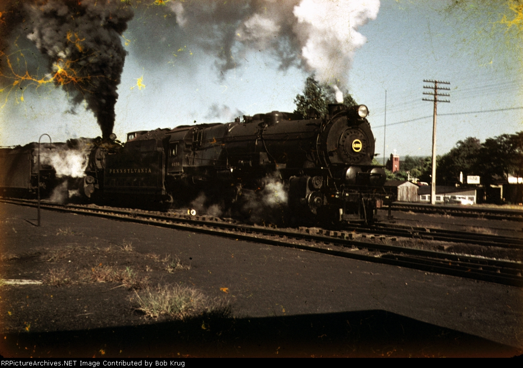
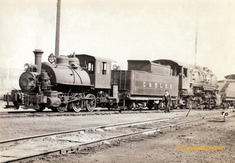
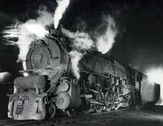
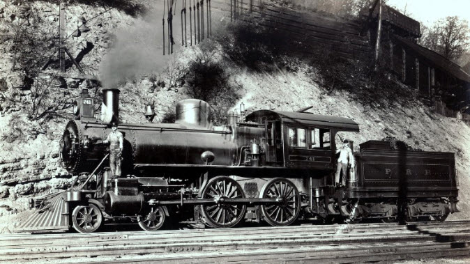
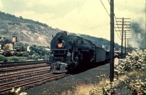
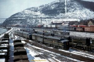
Johnstown was formally platted as Conemaugh Old Town in 1800 by the Swiss German immigrant Joseph Johns (born Josef Schantz). The settlement was initially known as “Schantzstadt”, but was soon anglicized to Johnstown. The community incorporated as Conemaugh borough January 12, 1831,[12] but renamed Johnstown on April 14, 1834.[13] From 1834 to 1854, the city was a port and key transfer point along the Pennsylvania Main Line Canal. Johnstown was at the head of the canal’s western branch, with canal boats having been transported over the mountains via the Allegheny Portage Railroad and refloated here, to continue the trip by water to Pittsburgh and the Ohio Valley. Perhaps the most famous passenger who traveled via the canal to visit Johnstown briefly was Charles Dickens in 1842. By 1854, canal transport became redundant with the completion of the Pennsylvania Railroad, which now spanned the state. With the coming of the railroads, the city’s growth improved. Johnstown became a stop on the main line of the Pennsylvania Railroad and was connected with the Baltimore & Ohio. The railroads provided large-scale development of the region’s mineral wealth.
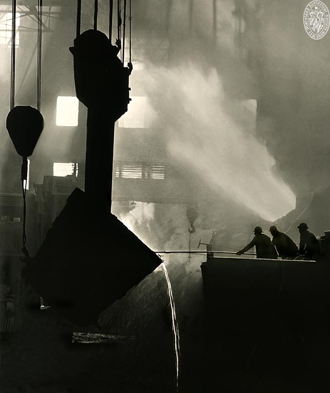
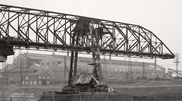
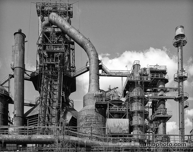
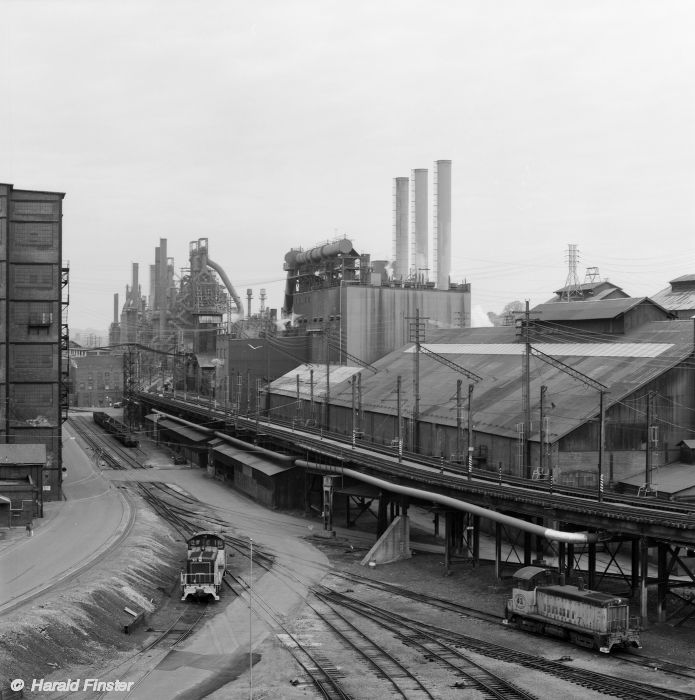
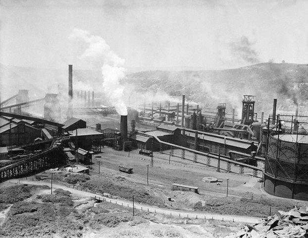
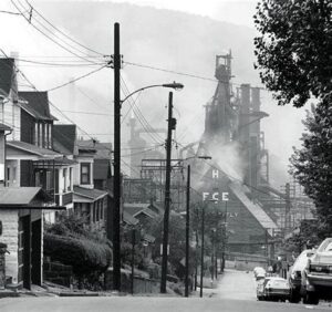
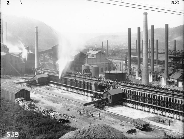
Iron, coal, and steel quickly became central to the town of Johnstown. By 1860, the Cambria Iron Company of Johnstown was the leading steel producer in the United States, outproducing steel giants in Pittsburgh and Cleveland. Through the second half of the 19th century, Johnstown made much of the nation’s barbed wire. Johnstown prospered from skyrocketing demand in the western United States for barbed wire. Twenty years after its founding, the Cambria Works was a huge enterprise sprawling over 60 acres (24 ha) in Johnstown and employing 7,000. It owned 40,000 acres (160 km2) of valuable mineral lands in a region with a ready supply of iron, coal and limestone.
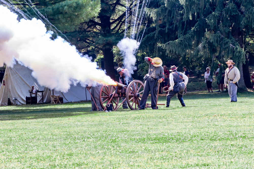
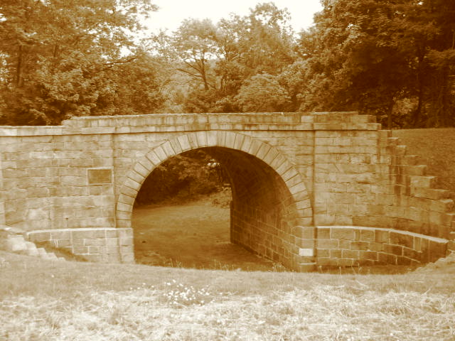
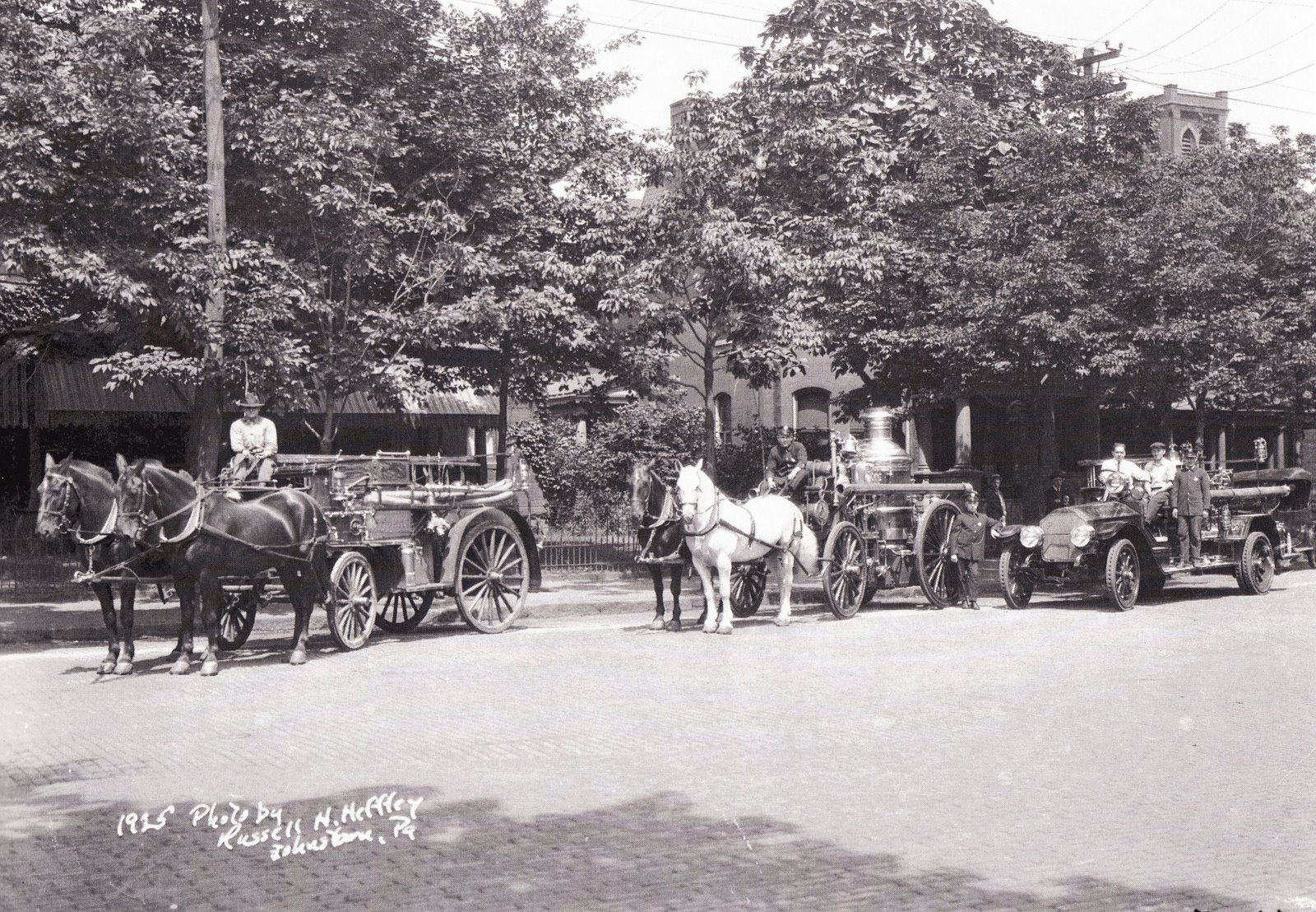
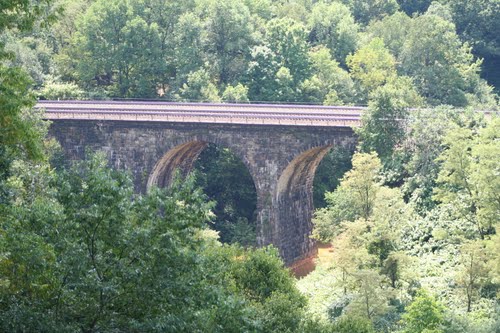
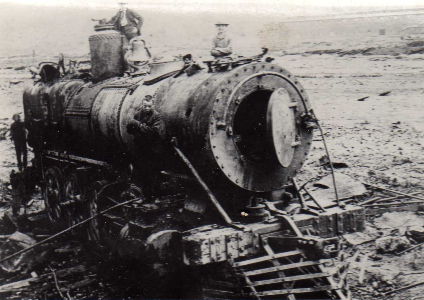
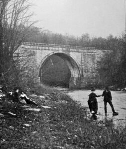
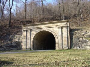
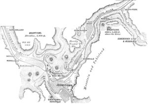
Floods were almost a yearly event in the valley during the 1880s. On the afternoon of May 30, 1889, following a quiet Memorial Day ceremony and a parade, it began raining in the valley. The next day water filled the streets, and rumors began that a dam holding an artificial lake in the mountains to the northeast might give way. It did, and an estimated 20 million tons of water began spilling into the winding gorge that led to Johnstown some 14 miles (23 km) away. The destruction in Johnstown occurred in only about 10 minutes. What had been a thriving steel town with homes, churches, saloons, a library, a railroad station, electric street lights, a roller rink, and two opera houses was buried under mud and debris. Out of a population of approximately 30,000 at the time, at least 2,209 people are known to have perished in the disaster. An infamous site of a major fire during the flood was the old stone Pennsylvania Railroad bridge located where the Stonycreek and Little Conemaugh rivers join to form the Conemaugh River. The bridge still stands today.[14]
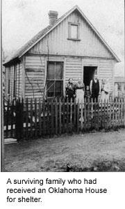
The Johnstown flood of 1889 established the American Red Cross as the pre-eminent emergency relief organization in the United States. Founder Clara Barton, then 67, came to Johnstown with 50 doctors and nurses and set up tent hospitals as well as temporary “hotels” for the homeless, and stayed on for five months to coordinate relief efforts.[15]
The mills were back in operation within a month. The Cambria Works grew, and Johnstown became more prosperous than ever. The disaster had not destroyed the community but strengthened it. Later generations would draw on lessons learned in 1889. After the successful merger of six surrounding boroughs,[citation needed] Johnstown became a city on April 7, 1890.[16]
20th century
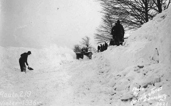
In the early 20th century, the population reached 67,000 people. The city’s first commercial radio station, WJAC, began broadcasts in 1925. The downtown boasted at least five major department stores, including Glosser Brothers, which in the 1950s gave birth to the Gee Bee chain of department stores. However, the St Patrick’s Day flood of 1936 combined with the gnawing effects of the Great Depression left Johnstown struggling again, but only temporarily. Johnstown’s citizens mobilized to achieve a permanent solution to the flooding problem and wrote to President Franklin Roosevelt pleading for federal aid. Starting in August 1938, continuing for the next five years, the U. S. Army Corps of Engineers gouged, widened, deepened, and realigned 9.2 miles (14.8 km) of river channel in the city, and encased the river banks in concrete and reinforced steel. In a campaign organized by the Chamber of Commerce, thousands of Johnstown’s citizens wrote to friends and relatives across the country hoping to bring new business to the town.
Professional ice hockey found a home in Johnstown, starting in 1941 with the Johnstown Blue Birds for one season and returning in 1950 with the Johnstown Jets. The Jets later hosted an exhibition game against Maurice Richard and the Montreal Canadiens on November 20, 1951. Newcomers to the town heard little about the tragic past. Johnstown proclaimed itself “flood-free”, a feeling reinforced when Johnstown was virtually the only riverside city in Pennsylvania not to flood during Hurricane Agnes in 1972.
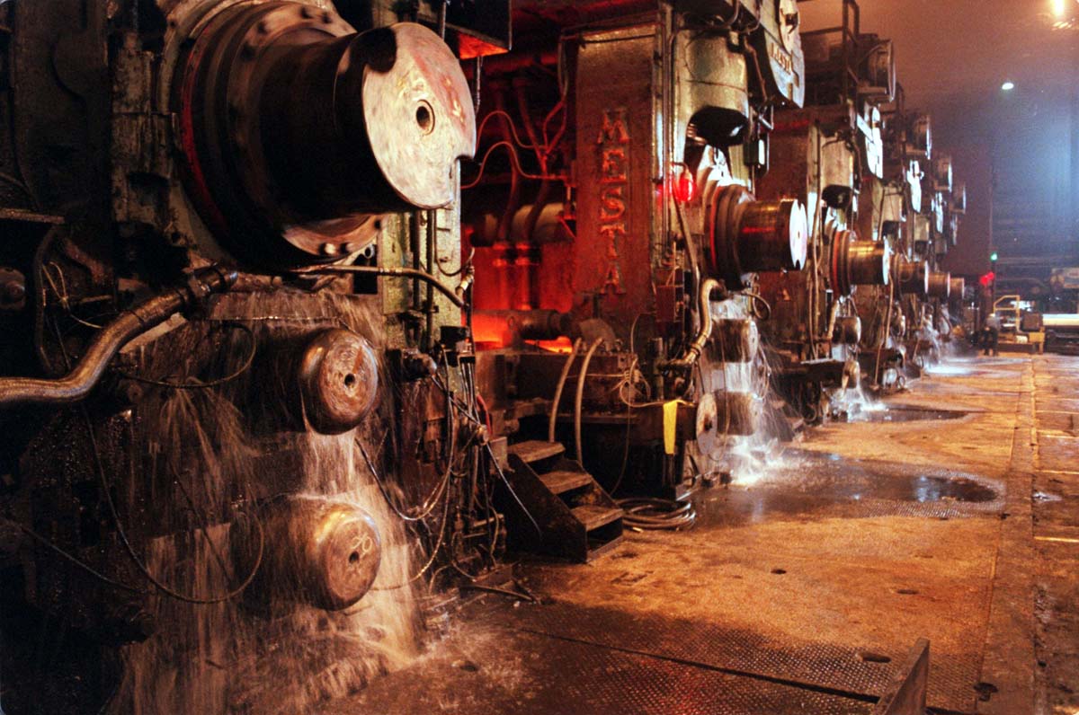
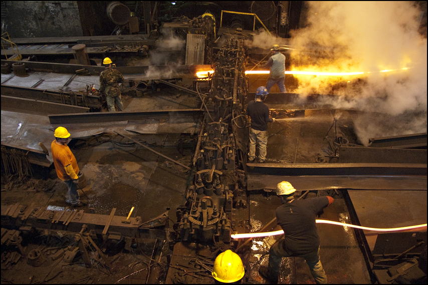
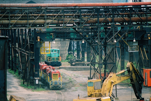
The immediate post-World War II years mark Johnstown’s peak as a steel maker and fabricator. At its peak, steel provided Johnstowners with more than 13,000 full-time, well-paying jobs. However, increased domestic and foreign competition, coupled with Johnstown’s relative distance from its primary iron ore source in the western Great Lakes, led to a steady decline in profitability. New capital investment waned. Johnstown’s mountainous terrain, and the resulting poor layout for the mills’ physical plant strung along 11 miles (18 km) of river bottom lands, compounded the problem.
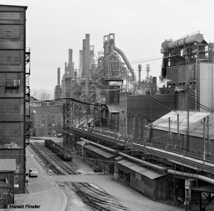
New regulations ordered by the EPA in the 1970s also hit Johnstown, with the aging Cambria plant (now Bethlehem Steel) especially hard. However, with encouragement from the steel company, the city fathers organized an association called Johnstown Area Regional Industries (JARI) and, within a year, raised $3 million for industrial development in the area. Bethlehem Steel, which was the major contributor to the fund, committed itself to bringing new steelmaking technologies to Johnstown because they were impressed by the city’s own efforts to diversify.
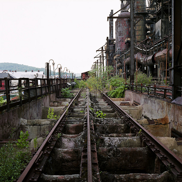
Extensive damage from the 1977 flood was heavy and there was talk of the company pulling out. Again, the city won a reprieve from the company’s top management, which had always regarded the Johnstown works with special affection because of its history and reputation. As the increasing amount of federal environmental regulations became more difficult to comply with and the issues with the aging manufacturing facilities grew more significant, and as steel companies began closing down plants all over the country, by 1982 it looked as if Johnstown had exhausted its appeals. By the early 1990s, Johnstown abandoned most of its steel production, although some limited fabrication work continues.
2000s
In 2003, U.S. Census data showed that Johnstown was the least likely city in the United States to attract newcomers; however, what were previously relatively weak opportunities provided by the local manufacturing and service economies have more recently begun to burgeon, attracting outsiders. Gamesa Corporación Tecnológica, a Spanish wind energy company, opened its first U.S. wind turbine blade manufacturing facility near here in 2006 which subsequently closed in 2014.[17] Several wind turbines are sited on Babcock Ridge, the “Eastern Continental Divide“, along the eastern edge of Cambria and Somerset counties. Lockheed Martin relocated a facility from Greenville, South Carolina, to Johnstown in 2008. Höganäs AB, a Swedish powdered metals manufacturer operates two plants in the region, one in the Moxham section of the city and also in nearby Hollsopple in Somerset County. Companies like Concurrent Technologies Corporation, DRS Laurel Technologies, ITSI Biosciences, Kongsberg Defense and more throughout the region are in business for themselves. Recent construction in the surrounding region, the downtown, and adjacent Kernville neighborhood—including a new 100,000-square-foot (9,300 m2) Regional Technology Complex that will house a division of Northrop Grumman, among other tenants—signal the increasing dependence of Johnstown’s economy on the U.S. government’s defense budget. The high-tech defense industry is now the main non-health-care staple of the Johnstown economy, with the region pulling in well over $100M annually in federal government contracts, punctuated by one of the premier defense trade shows in the U.S., the annual Showcase for Commerce.[citation needed]
Johnstown remains a regional medical, educational, cultural, and communications center. As in many other locales, health care provides a significant percentage of the employment opportunities in the city. The region is located right in the middle of the “Health Belt”, an area stretching from the Midwest to New England and down the East Coast that has had massive growth in the health care industry. Major health care centers include Memorial Medical Center and Windber Medical Center, the Laurel Highlands Neuro-Rehabilitation Center, and the John P. Murtha Neuroscience and Pain Institute, with its advances in treating wounded veterans, and the Joyce Murtha Breast Care Center’s focus on early diagnosis and advanced treatment.[18]
The University of Pittsburgh at Johnstown and Pennsylvania Highlands Community College attract thousands of students to their contiguous campuses in Richland, 5 miles (8 km) east of Johnstown. Cambria-Rowe Business College, located in the Moxham section of Johnstown, offers concentrated career training and has continuously served Johnstown since 1891. The Pasquerilla Performing Arts Center, a concert/theatrical venue at the University of Pittsburgh at Johnstown, attracts high-quality performers. The Johnstown Symphony Orchestra and the recently formed Johnstown Symphony Chamber Players provide classical music. The Johnstown Concert Ballet, centered in the Historic Cambria City District, provides classical ballet performances and training to the area. The Pasquerilla Convention Center was recently constructed downtown, adjacent to the historic Cambria County War Memorial Arena at 326 Napoleon Street. Point Stadium, a baseball park where Babe Ruth once played, was razed and rebuilt. A zoning ordinance created an artist zone and a traditional neighborhood zone to encourage both artistic endeavors and the old-fashioned “Mom and Pop” enterprises that had difficulty thriving under the previous code. The Bottleworks Ethnic Arts Center offers many exhibitions, events, performances, and classes that celebrate the rich and diverse cultural heritage of the area.
The Johnstown Chiefs ice hockey team played for 22 seasons, the longest period a franchise of the league stayed in one city. The Chiefs were a member team of the ECHL, and played their home games in the Cambria County War Memorial Arena. The Chiefs’ decision to relocate caused a flood of public interest in the sport of hockey. As many as four leagues were interested in having a team in the War Memorial. In the end the city landed a deal with another ECHL team, the Wheeling Nailers, who played parts of two seasons at the War Memorial. A full-time tenant arrived in 2012, when the Johnstown Tomahawks of the junior North American Hockey League began play.
The recently established ART WORKS in Johnstown! houses artist studios in some of the area’s architecturally significant but underused industrial buildings. The ART WORKS in Johnstown project is projected to be a non-profit LEED-certified green building. The Frank & Sylvia Pasquerilla Heritage Discovery Center opened in 2001 with the permanent exhibit “America: Through Immigrant Eyes”, which tells the story of immigration to the area during the Industrial Revolution. In June 2009, the Heritage Discovery Center opened the Johnstown Children’s Museum and premiered “The Mystery of Steel”, a film detailing the history of steel in Johnstown. The Bottleworks Ethnic Arts Center, ART WORKS, and the Heritage Discovery Center are located in the historic Cambria City section of town, which boasts a variety of eastern European ethnic churches and social halls. This neighborhood hosted the National Folk Festival for three years in the early 1990s, which expanded into the Flood City Music Festival. Johnstown also hosts the annual Thunder in the Valley motorcycle rally during the fourth week of June; the event has attracted motorcyclists from across the Northeast to the city of Johnstown since 1998. Well over 200,000 participants enjoyed the 2008 edition of Thunder in the Valley, and the event continues to grow in size.
Significant efforts have been made to deal with deteriorating housing, brownfields, drug problems, and other issues as population leaves the city limits and concentrates in suburban boroughs and townships. The Johnstown Fire Department has become a leader in developing intercommunication systems among first responders, and is now a national model for ways to avoid the communications problems which faced many first responders during the September 11, 2001 attacks.

Jim Mayer Riverwalk Trail in Johnstown Part 14
Named for a local conservationist, the Jim Mayer Riverswalk Trail is a delightful, 3.1-mile (5k) urban trail on the east end of the City of Johnstown. Following the Stonycreek River, the trail begins in Riverside on Michigan Ave. and ends in Hornerstown on Messenger St., near Sandyvale Memorial Gardens & Conservancy. This trail offers beautiful views of the river, abundant bird-life and wildflowers, picturesque Buttermilk Falls and serenity within an urban setting.
The Jim Mayer Riverswalk Trail is part of a growing urban trail system in Johnstown that currently follows the Stonycreek River from Central Avenue behind an industrial complex to the residential community of Riverside. One of its best features is the 50-foot Buttermilk Falls, located about mid-trail between Bridge Street and Riverside. The Riverswalk is nearly level, and its surface is groomed and easily ridden or walked


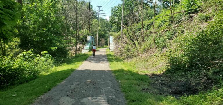
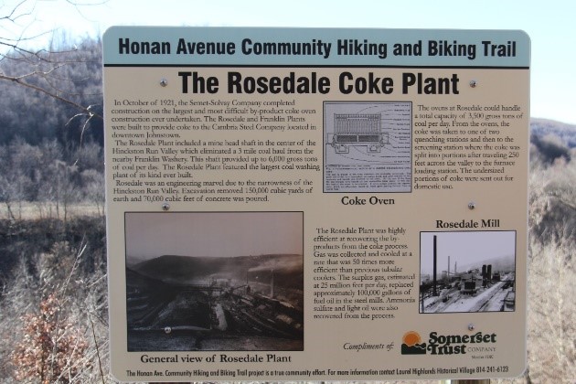
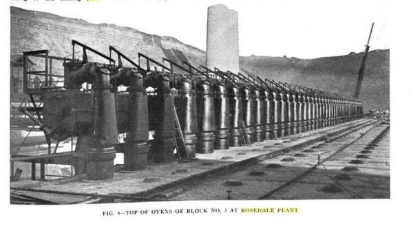
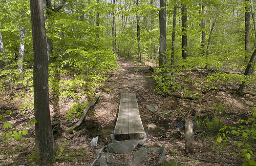
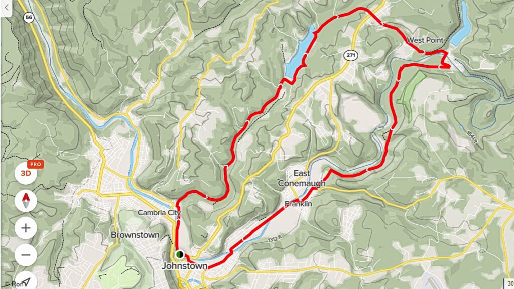
Honan Ave Hiking & Biking Trail
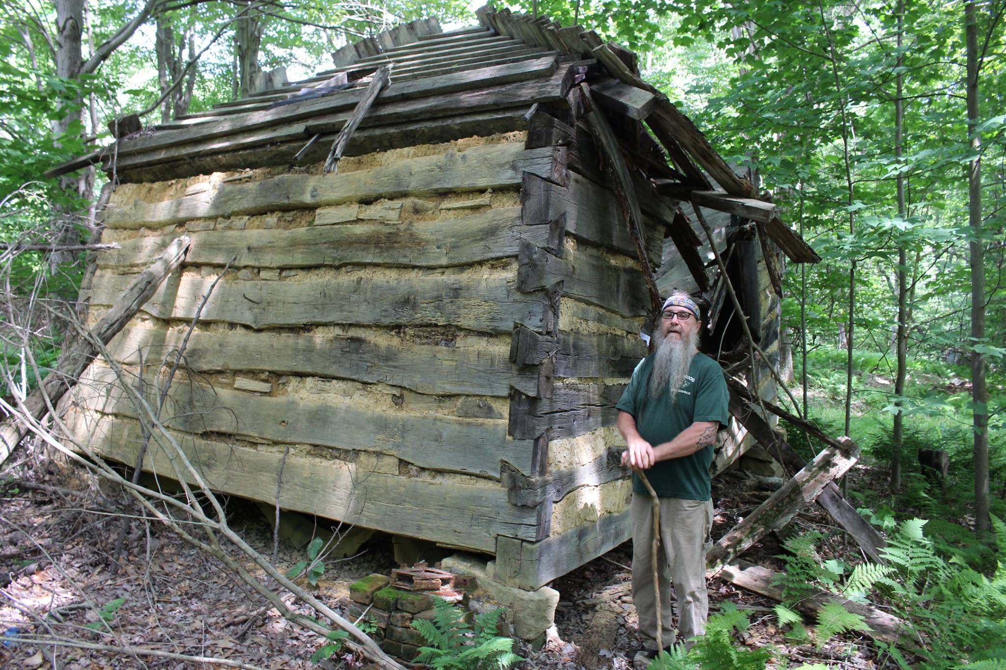
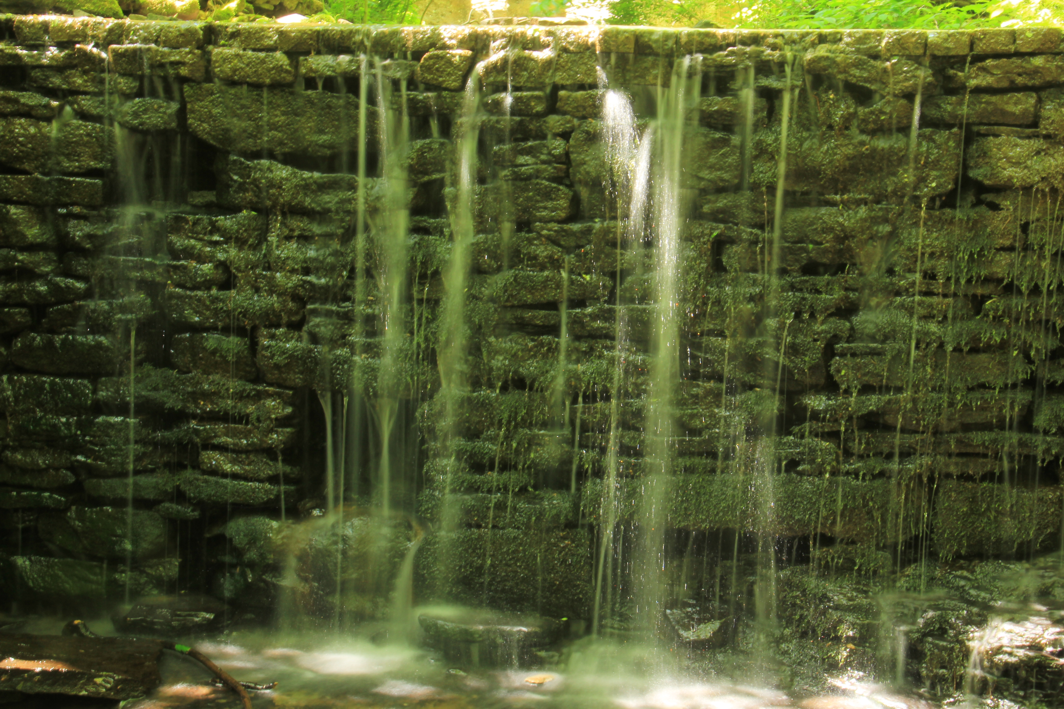
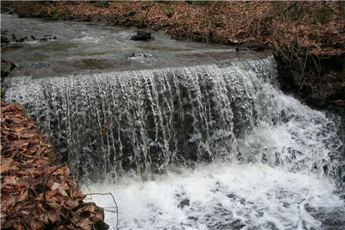
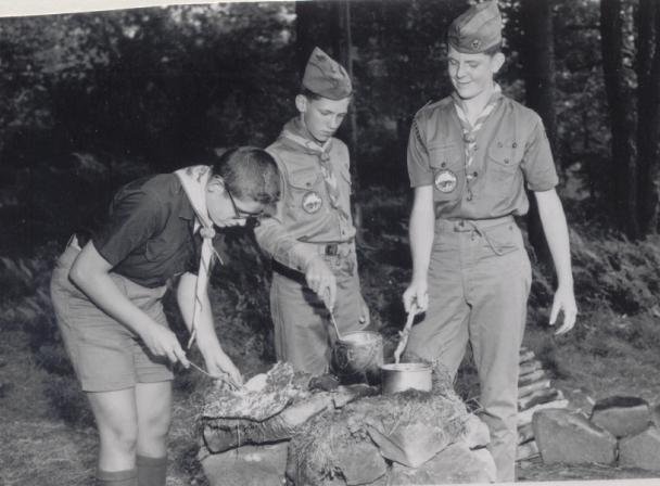
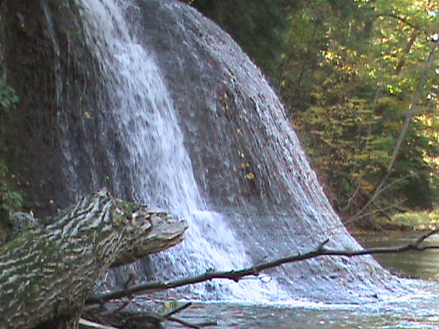
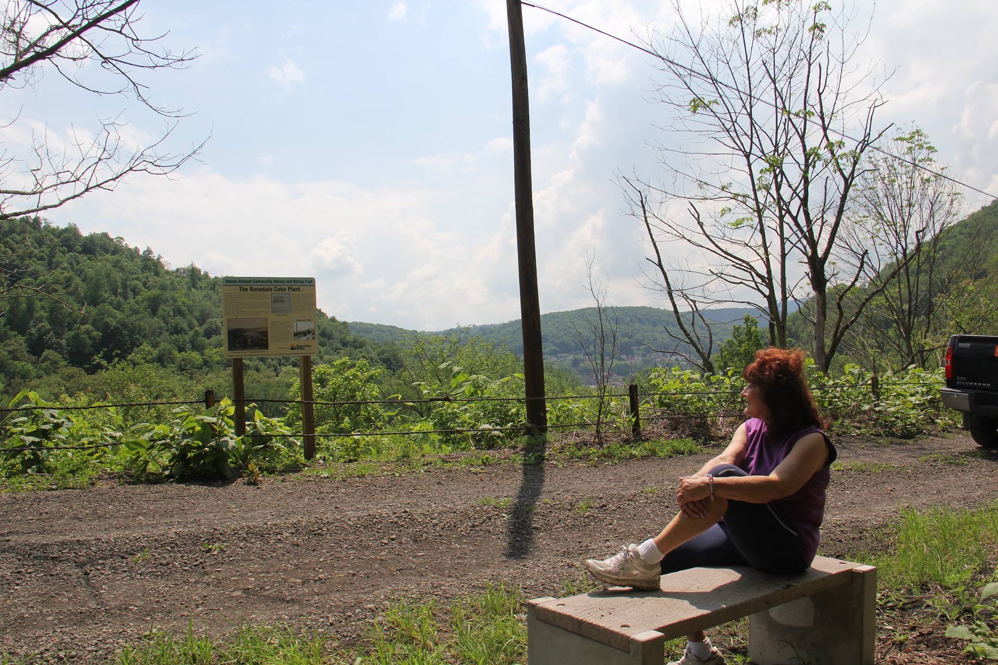
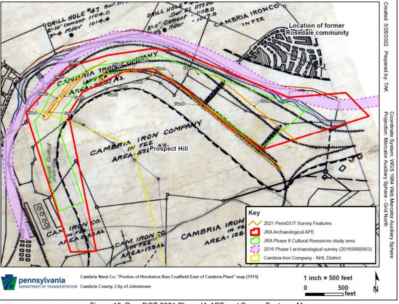
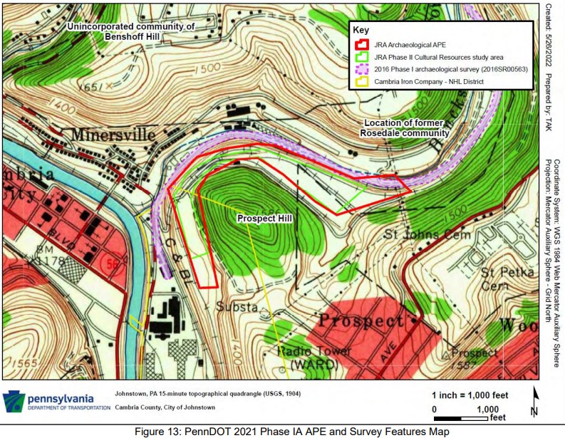
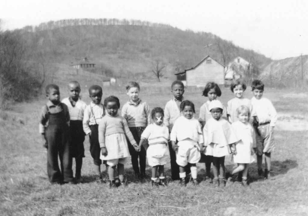
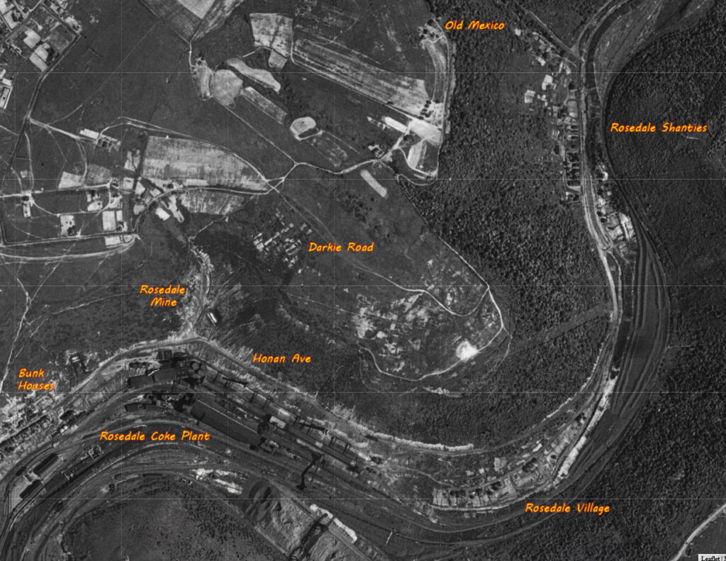
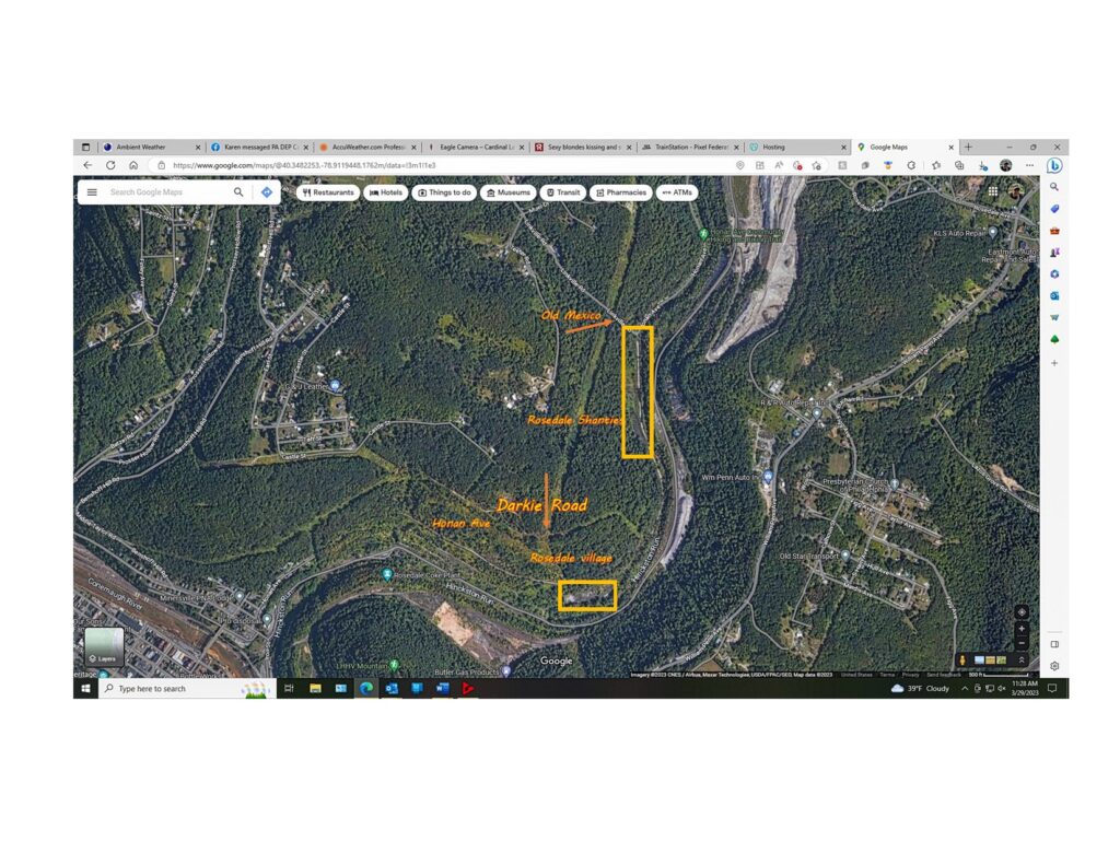
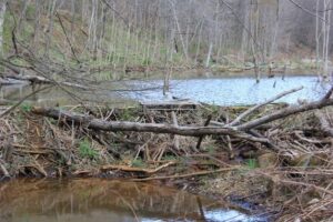
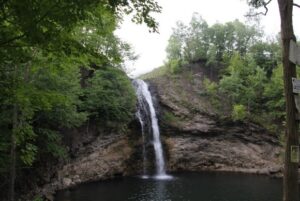
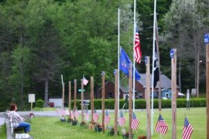
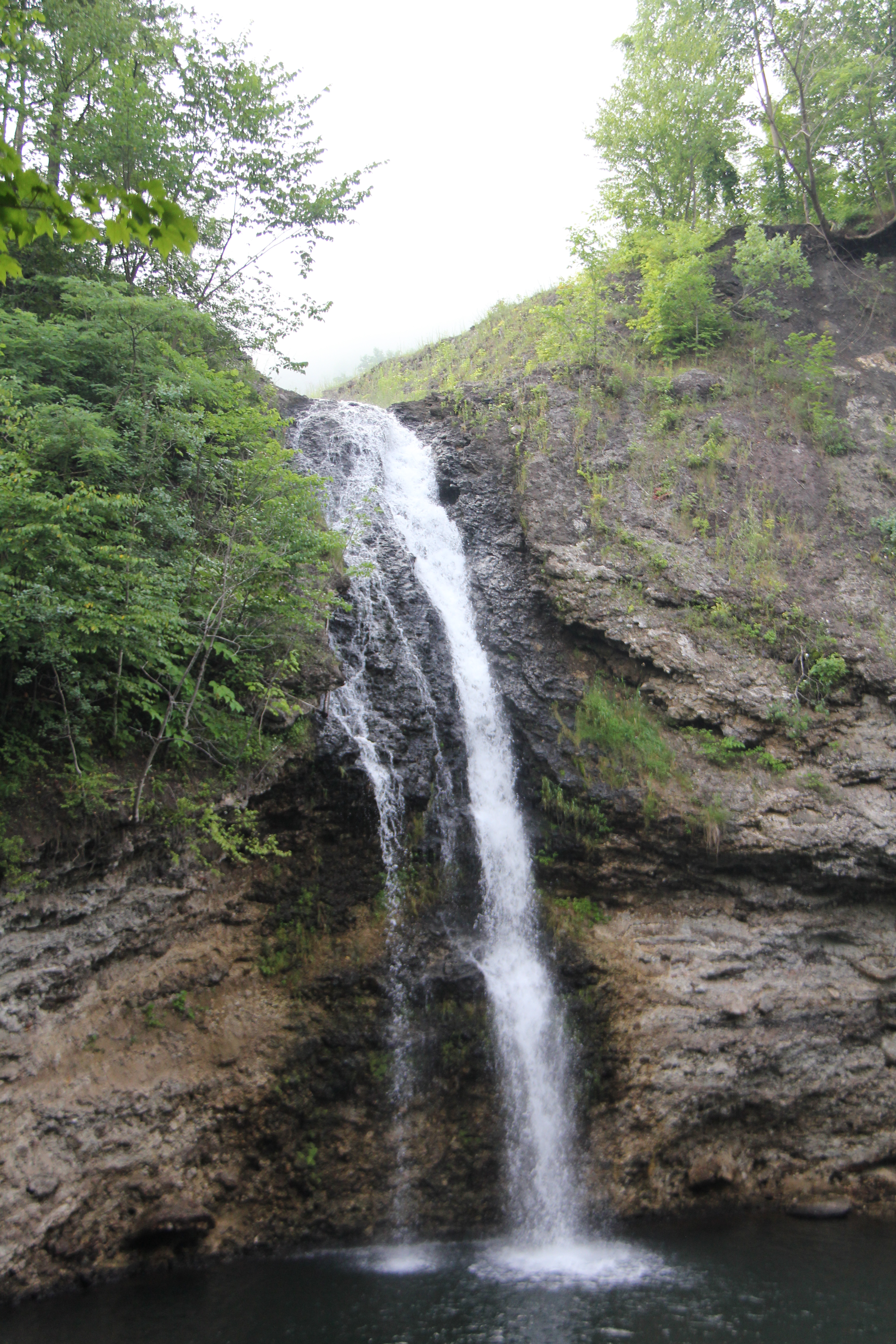
What Started as a radio interview with the Late great Congressman John P. Murtha, a foundation of people working together to achieve a common goal. During that interview the congressman talked about the region and its deep ethnic roots, and how the people could unite together and preserves our deep rich ethnic communities. Ron Shawley continued to interview the congressman and he got the idea of starting an organization built on the foundation of preserving our many ethnic groups. Today Laurel Highlands Historical Village continues to provide not only an education concerning our ethnic heritage but building a network of trails that allow persons to walk thru the remnants of a once power house steel mill operation, ending at a huge waterfall and beautiful lake. The Trail is also being dedicated for all veterans from the region. The Trail starting in Minersville runs for 3.5 miles passing a huge Beaver dam, a huge waterfall and the remnants of the Rosedale Coke plant. Honan Ave was once well traveled as children and their parents would walk and bike to the top where they would spend the day away fishing. After the 77 flood the road seemed to just fall apart, long gone were the presence of foot traffic and bicycles. Today people young and old alike can make the journey up this trail, and spend the day at Hinckston Reservoir fishing and having a picnic.


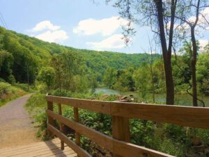
Explore The Eagle trail
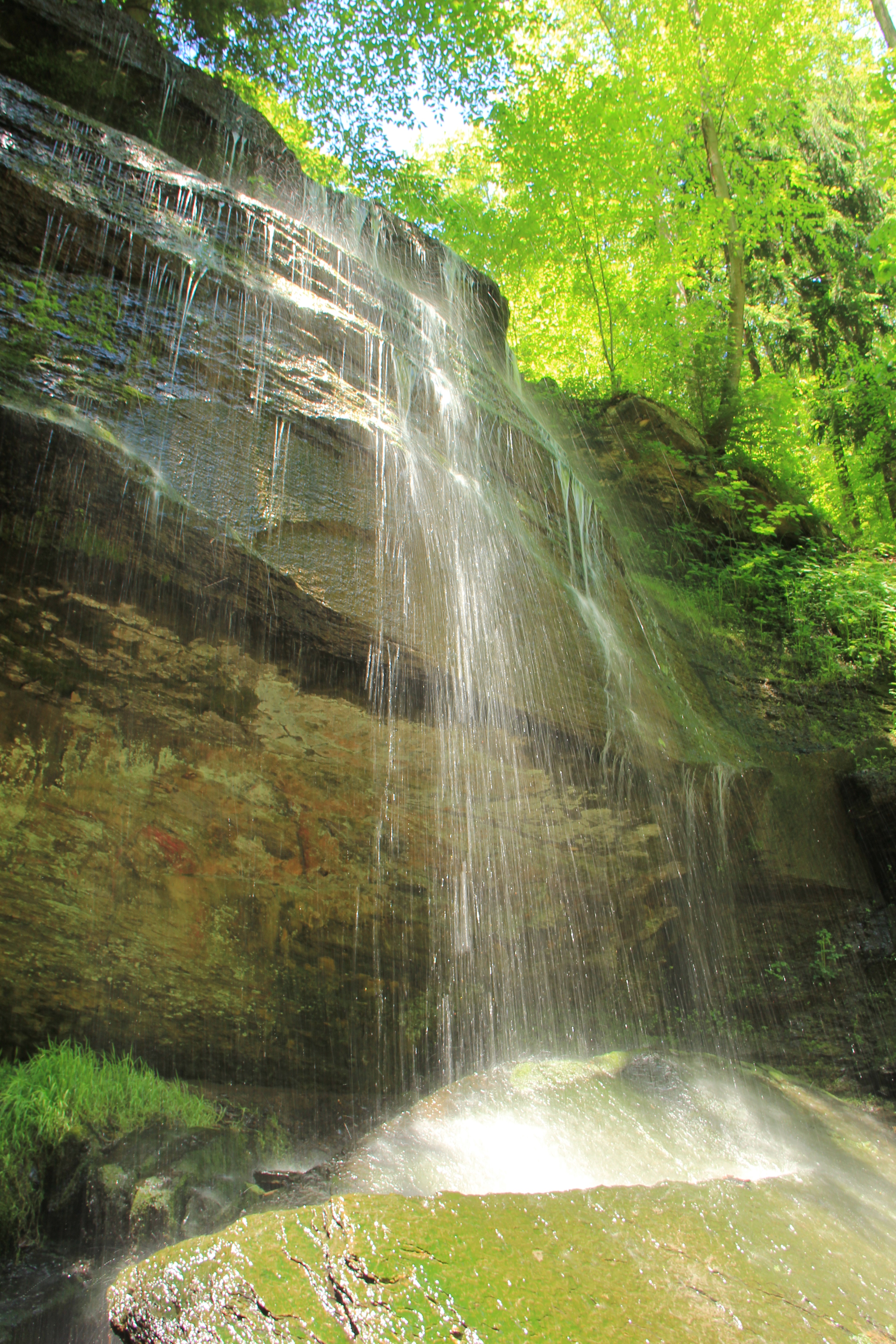
Located Behind the Hinckston Run Dam is the Eagle Trail so named because of recent visiting Eagles who their to feed. The trail is short with some small hills. Along the trail are waterfalls, historic foundations, woodlands birds, waterfowl,, Deer and other small animals. The trail parallels the dam for a short way then turns west heading towards waterfall road where it ends.

Explore Joseph P Whipey Trail
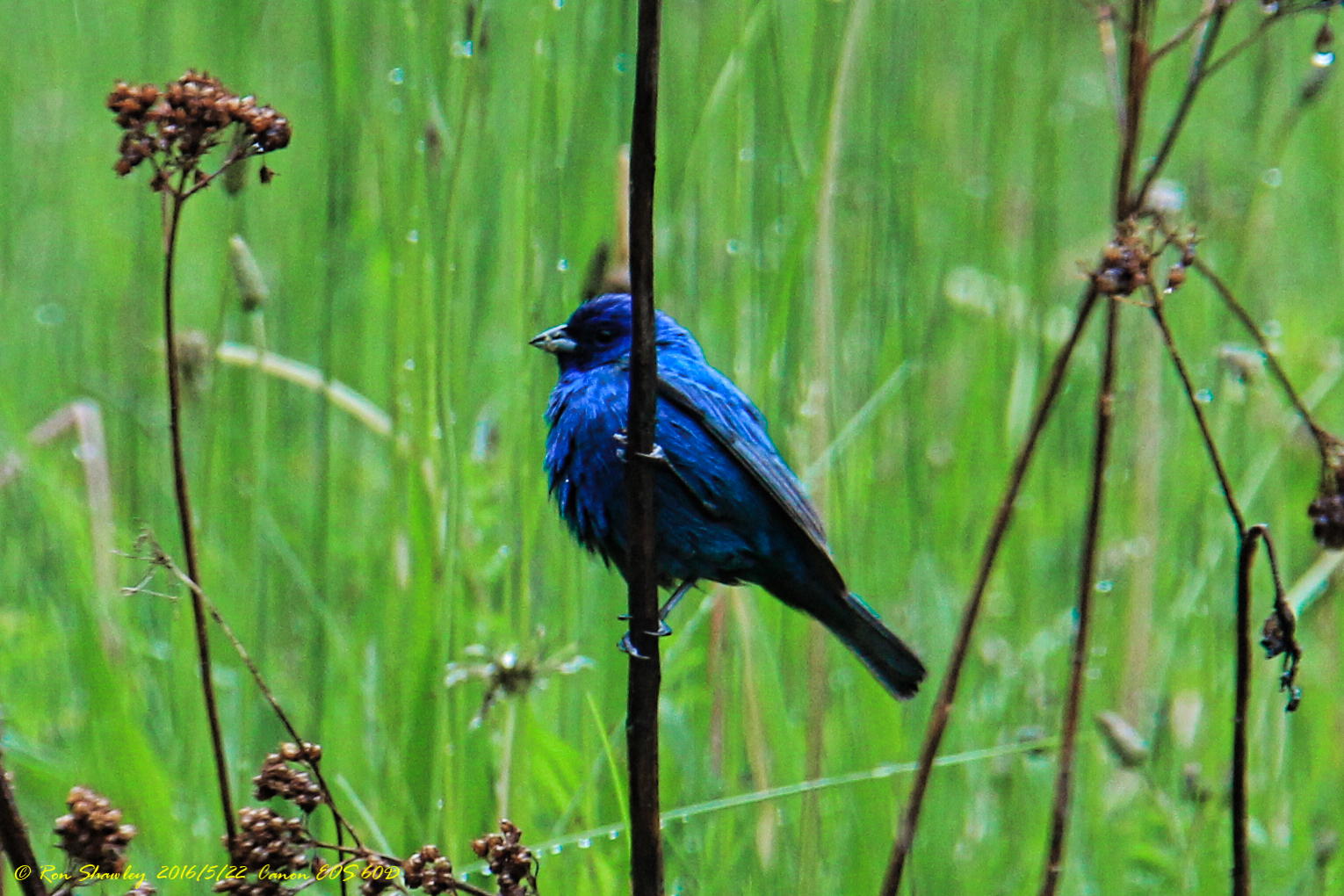
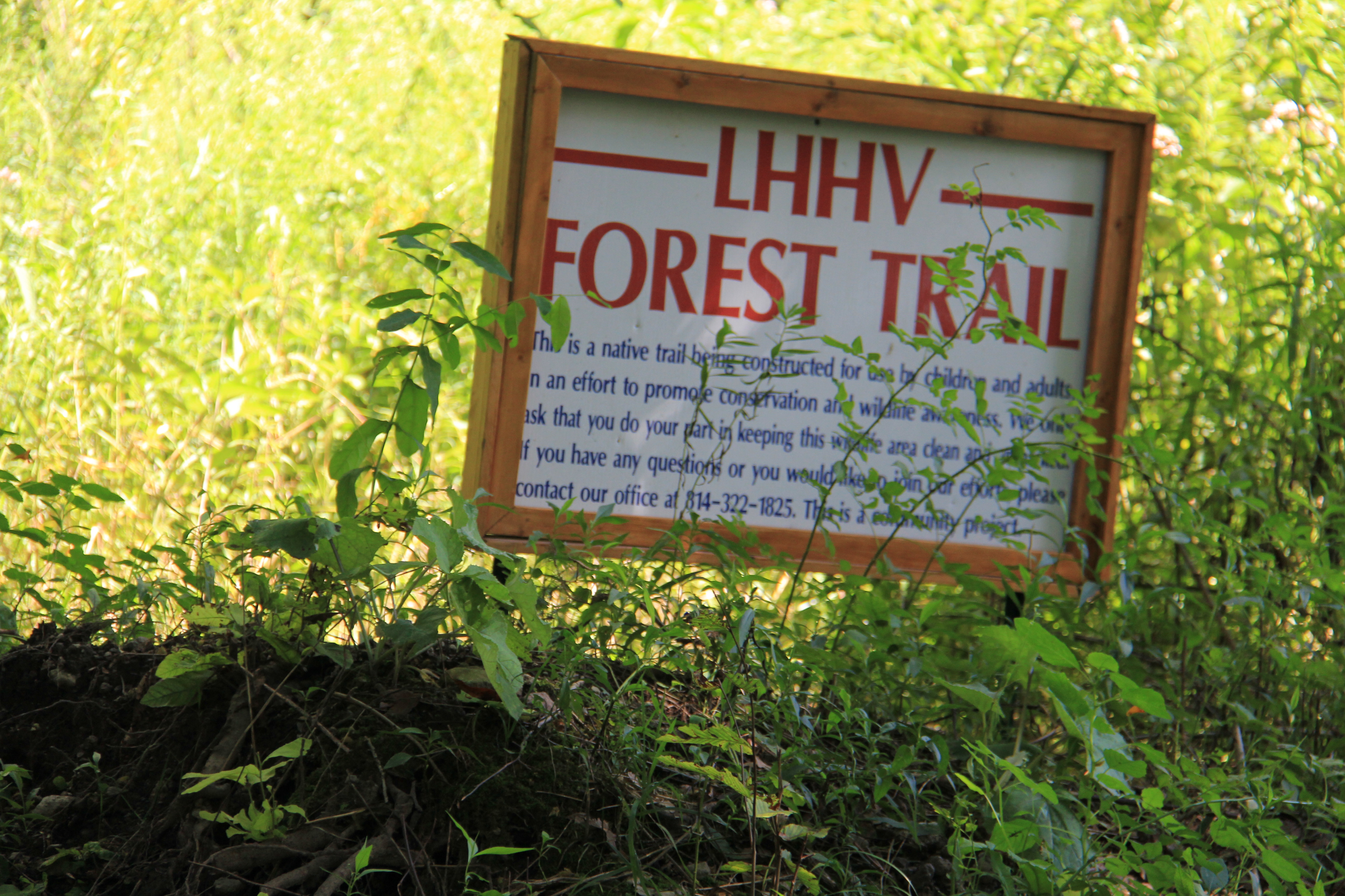
The LHHV Forest The LHHV Experimental Forest, located 3 miles north of Johnstown, in Middle & East Taylor townships, offers quiet refuge to all who seek the natural enchantment of a forest experience. Tucked away in the heart of the Hinckston Run Dam , the Forest is bordered on its Western ridge boundaries by the Hinckston Dam Wildlife Management Area. The LHHV Forest is located on property that surrounds Hinckston Reservoir . Our hiking trails encompass the wooded area itself. The trail as listed above has stops for resting and watching the area wildlife. We have local students who utilize the Forest Trail as an outside classroom. We are seeking funding to support wildlife projects, i.e. Eagles, blue Birds nest etc. The hiking trail will starts at current pavilion and running in the same direction as the road which runs the length of reservoir. The total length of trail is 1 mile. At the ¾ mile marker we have an over look whereby hikers are able to sit and watch the water foul and birds. We built the Eagle trail which goes around the western flank of reservoir, ¾ mile trail. On the Eagle Trail you can view Eagles, waterfalls and other wildlife. Also bring your fishing gear, as we have some of the finest fishing in region.